Mrs. Mossy Posted November 20, 2008 Share Posted November 20, 2008 And it's not even a snow day!!!! Link to comment Share on other sites More sharing options...
SlowTouringGuy Posted November 20, 2008 Share Posted November 20, 2008 Nice Pix Mrs. M ! Nice Pix. Will you be riding today ?? (or did Mossy go to work?) Link to comment Share on other sites More sharing options...
Mrs. Mossy Posted November 20, 2008 Author Share Posted November 20, 2008 Yes Mossy did go to work...and I'm sure he had a wonderful drive.... I was thinking of breaking out the sled to take the kids to the bus stop....but I don't know if I can find it under all the snow!!! Link to comment Share on other sites More sharing options...
SlowTouringGuy Posted November 20, 2008 Share Posted November 20, 2008 Break out the Sled !! Those pix make it look like a great day to ride !! Link to comment Share on other sites More sharing options...
skidooer Posted November 20, 2008 Share Posted November 20, 2008 Whoa. We only have half that much down here in the sunny southern half of the HC. If my sled was ready to go I would have been coming to pay you a visit today. Link to comment Share on other sites More sharing options...
SlowTouringGuy Posted November 20, 2008 Share Posted November 20, 2008 Whoa. We only have half that much down here in the sunny southern half of the HC. If my sled was ready to go I would have been coming to pay you a visit today. gET oUT mRS. mOSSY ! RUN WHILE YOU CAN Link to comment Share on other sites More sharing options...
wenailem1 Posted November 21, 2008 Share Posted November 21, 2008 COLLLASO (monkey spell) sno squallage action in aurburnville, gg gf gh S or in your cases, who plows the streets there? gs sno squallies rip :carsled: :carsled: :carsled: :carsled: :carsled: to auburn! tallyho Link to comment Share on other sites More sharing options...
Mrs. Mossy Posted November 21, 2008 Author Share Posted November 21, 2008 I'll let you know when they open the trails!!! (might be awhile ~ they haven't even been staked yet!!!) Link to comment Share on other sites More sharing options...
PISTON LAKE CRUISER Posted November 22, 2008 Share Posted November 22, 2008 Mrs. Mossy: The picture off your back porch out towards main street reminds me of the time I snuck through there between the church and what was then Bradnock's on my Dad's Husky snowmobile to escape an OPP patrol car that would have loved to catch a 12 year old terrorizing the streets of Auburn. While you may not know what a Husky looked like, I'm sure there are a few reading this that do remember them. I am going to say that that was probably the winter of 1963. Many things have changed with sleds and with Auburn since then! Link to comment Share on other sites More sharing options...
Mrs. Mossy Posted November 22, 2008 Author Share Posted November 22, 2008 Mrs. Mossy: The picture off your back porch out towards main street reminds me of the time I snuck through there between the church and what was then Bradnock's on my Dad's Husky snowmobile to escape an OPP patrol car that would have loved to catch a 12 year old terrorizing the streets of Auburn. While you may not know what a Husky looked like, I'm sure there are a few reading this that do remember them. I am going to say that that was probably the winter of 1963. Many things have changed with sleds and with Auburn since then! Does that mean that you lived in my house? What a small world!!! You are so right!!! There have been many changes even since I was a little girl (1975?)....we lived in the big white house on the hill across the river....they just burned it down 2 weeks ago!!! No General Store anymore, just the gas station/restaurant out on the highway. That church behind us is now a house and the Huron Chapel now resides across the road from us in what used to be a beautiful field.... I swear we received 2 more feet of snow yesterday afternoon!!! I'll take more pics this aft to post....unreal!!! And they are saying possible rain for Monday.... Link to comment Share on other sites More sharing options...
Mrs. Mossy Posted November 22, 2008 Author Share Posted November 22, 2008 Ok...here's some more pics...keep the drool to a minimum!!! Link to comment Share on other sites More sharing options...
IndySKS Posted November 22, 2008 Share Posted November 22, 2008 The license plate says it all ! Link to comment Share on other sites More sharing options...
PISTON LAKE CRUISER Posted November 22, 2008 Share Posted November 22, 2008 Mrs. Mossy: No, I never lived in your house but I did weather about 24 winters in Auburn. There aren't many places in southern Ontario that get more snow than inland Huron County. The Lee of the lakes ! Ya gotta love it. Bye the way, the Red Maple tree behind the Wintery looking Auburn Weather Station was planted in my Father's memory. Link to comment Share on other sites More sharing options...
Mrs. Mossy Posted November 23, 2008 Author Share Posted November 23, 2008 Mrs. Mossy: No, I never lived in your house but I did weather about 24 winters in Auburn. There aren't many places in southern Ontario that get more snow than inland Huron County. The Lee of the lakes ! Ya gotta love it. Bye the way, the Red Maple tree behind the Wintery looking Auburn Weather Station was planted in my Father's memory. Don't you worry PLC ~ I'll get the goods on that...I know Sandy Andrews (the next best town gossip)!!! Link to comment Share on other sites More sharing options...
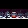
FreezerBurnt Posted November 24, 2008 Share Posted November 24, 2008 The license plate says it all ! Yup love the licence plate here's mine though we need more snow here Link to comment Share on other sites More sharing options...
Canuck Posted December 16, 2008 Share Posted December 16, 2008 Wow. More snow in Parry Sound - Muskoka - Huntsville SNOWSQUALL WARNING: Parry Sound - Muskoka - HuntsvilleIssued at 5:15 PM EST MONDAY 15 DECEMBER 2008 SNOWSQUALLS WITH WHITEOUT CONDITIONS EXPECTED TONIGHT. THIS IS A WARNING THAT SNOWSQUALLS ARE IMMINENT OR OCCURRING IN THESE REGIONS. MONITOR WEATHER CONDITIONS..LISTEN FOR UPDATED STATEMENTS. OFF GEORGIAN BAY..STRONG WEST WINDS ARE GENERATING SNOWSQUALLS WHICH ARE CURRENTLY AFFECTING REGIONS FROM NEAR COLDWATER AND MIDLAND TO JUST NORTH OF PARRY SOUND. SNOWSQUALLS OFF LAKE HURON ARE AFFECTING THE BRUCE PENINSULA NORTH OF SOUTHAMPTON. THE HIGHEST SNOWFALL AMOUNTS ARE EXPECTED TO BE TO THE LEE OF GEORGIAN BAY WHERE LOCAL ACCUMULATIONS MAY REACH 10 TO 15 IN 12 HOURS. PORTIONS OF THE BRUCE PENINSULA COULD SEE 10 CENTIMETRES TONIGHT. FREQUENT WHITEOUT CONDITIONS FROM BLOWING SNOW ARE EXPECTED. THE SQUALLS ARE EXPECTED TO WEAKEN CONSIDERABLY EARLY TUESDAY MORNING WITH LIGHTER LAKE EFFECT FLURRIES PERSISTING INTO TUESDAY AFTERNOON. DRIVERS SHOULD BE PREPARED FOR DANGEROUS DRIVING CONDITIONS DUE TO SUDDEN ZERO VISIBILITY IN BURSTS OF HEAVY SNOW AND BLOWING SNOW. Link to comment Share on other sites More sharing options...
Mrs. Mossy Posted December 16, 2008 Author Share Posted December 16, 2008 We are supposed to start getting our snow back tonight ~ but the radar looks very strange....we are in the eye of the hurricane!!! Link to comment Share on other sites More sharing options...
skidooer Posted December 17, 2008 Share Posted December 17, 2008 but the radar looks very strange....we are in the eye of the hurricane!!! That is cool! Link to comment Share on other sites More sharing options...
Wildbill Posted December 17, 2008 Share Posted December 17, 2008 Almost 8 inches of snow fell here last night . The rain only set the base . Now we need the water crossings to freeze up . Link to comment Share on other sites More sharing options...
wenailem1 Posted December 17, 2008 Share Posted December 17, 2008 but the radar looks very strange....we are in the eye of the hurricane!!! That is cool! ITS A ALBERTA CCCCCCCCLLLLLLLLLLIIIIIIIIIIIIIIIIIIIIIIIIPPPPPPPPPPPEEEEEEEEEEERRRRRRRRRRRRRRRR, :carsled: :carsled: :carsled: tallly hoegg gf gh SAFE or in our case, ITS QUITE POSSSSSSSIBBBBBLEEE WEEEEE MIGHT GGGGGETTTT AAAA REAAALITTIVEEEELY OUTSIIDE CHANCE OF SNOOOOOOOOOOOOOOOOOOOOOOOOOOOOOOO Link to comment Share on other sites More sharing options...
Mrs. Mossy Posted December 17, 2008 Author Share Posted December 17, 2008 but the radar looks very strange....we are in the eye of the hurricane!!! That is cool! Thanks Skidooer ~ I was trying to post the picture....photobucket didn't like it... It's snowing sideways right now...I hope it doesn't get too bad before Mossy gets home. Link to comment Share on other sites More sharing options...
Wildbill Posted December 17, 2008 Share Posted December 17, 2008 but the radar looks very strange....we are in the eye of the hurricane!!! That is cool! Thanks Skidooer ~ I was trying to post the picture....photobucket didn't like it... It's snowing sideways right now...I hope it doesn't get too bad before Mossy gets home. No worries Mossy will be ok . Link to comment Share on other sites More sharing options...
Navigator Posted December 17, 2008 Share Posted December 17, 2008 Just received this at work --- "SnowMageddon" ?? WOCN11 CWTO 171517 SPECIAL WEATHER STATEMENT ISSUED BY ENVIRONMENT CANADA ONTARIO REGION. 10:17 AM EST WEDNESDAY 17 DECEMBER 2008. SPECIAL WEATHER STATEMENT ISSUED FOR.. CITY OF TORONTO WINDSOR - ESSEX - CHATHAM-KENT SARNIA - LAMBTON ELGIN LONDON - MIDDLESEX SIMCOE - DELHI - NORFOLK DUNNVILLE - CALEDONIA - HALDIMAND OXFORD - BRANT NIAGARA CITY OF HAMILTON HALTON - PEEL YORK - DURHAM HURON - PERTH WATERLOO - WELLINGTON DUFFERIN - INNISFIL GREY - BRUCE BARRIE - ORILLIA - MIDLAND BELLEVILLE - QUINTE - NORTHUMBERLAND KINGSTON - PRINCE EDWARD PETERBOROUGH - KAWARTHA LAKES STIRLING - TWEED - SOUTH FRONTENAC BANCROFT - BON ECHO PARK BROCKVILLE - LEEDS AND GRENVILLE CITY OF OTTAWA GATINEAU PRESCOTT AND RUSSELL CORNWALL - MORRISBURG SMITHS FALLS - LANARK - SHARBOT LAKE PARRY SOUND - MUSKOKA HALIBURTON RENFREW - PEMBROKE - BARRY'S BAY ALGONQUIN BURK'S FALLS - BAYFIELD INLET. ..COULD THIS BE SNOW-MAGEDDON?.. ENVIRONMENT CANADA IS GENERALLY NOT PRONE TO EXAGGERATION UNLESS THERE IS DEEMED TO BE A REAL THREAT. WE EVALUATE WEATHER INFORMATION AND PREDICTION MODELS IN A MEASURED, SCIENTIFIC MANNER AND COUPLE THAT WITH OVERALL IMPACTS FOR SIGNIFICANT EVENTS. MOTHER NATURE FROM TIME TO TIME WILL LINE UP A NEAR PERFECT SET OF CONDITIONS THAT GENERATE A SERIES OF SIGNIFICANT EVENTS. THAT TIME APPEARS TO BE THE COMING WEEK OR SO FOR MANY PORTIONS OF SOUTHERN ONTARIO IN THE FORM OF SNOW STORMS. THERE APPEARS TO THE RIGHT BALANCE OF SUFFICIENTLY COLD AIR IN PLACE, WITH ARCTIC HIGHS TO THE NORTH AND A STORM TRACK ALONG THE LOWER GREAT LAKES. THE TERM 'SNOW-MAGEDDON' IS NOT MEANT TO ALARM ANYONE OR MAKE LIGHT OF THE SITUATION, BUT TO HIGHLIGHT THE CUMULATIVE EFFECTS AND IMPACTS THAT A SERIES OF SNOW STORMS CAN HAVE ON A WIDE REGION. A BLANKET OF 10 CENTIMETRES HAS JUST FALLEN ACROSS MUCH OF THE LOWER GREAT LAKES. BUT A MUCH MORE SIGNIFICANT SNOW STORM IS TARGETING THE REGION ON FRIDAY. MOST WEATHER GUIDANCE CONTINUES TO TRACK A STORM CENTRE FROM COLORADO ON THURSDAY TO JUST SOUTH OF THE GREAT LAKES ON FRIDAY. IT APPEARS HEAVY SNOW ACCOMPANIED BY STONG EASTERLY WINDS WILL CREATE A PARTICULARLY NASTY SNOW EVENT. ACCUMULATIONS MAY WELL REACH OR EXCEED 15 TO 20 CENTIMETRES. STRONG EASTERLY WINDS GUSTING TO 50 OR 60 KM/H WILL COMPOUND THE SEVERITY OF THE STORM WITH APPRECIABLE BLOWING AND DRIFTING SNOW AND VERY POOR VISIBILITIES. THERE IS ALSO THE POSSIBILITY OF ICE PELLETS OR FREEZING RAIN MIXED WITH THE SNOW FROM THE SOUTHWEST AND EAST ACROSS NIAGARA. A WINTER STORM WATCH WILL LIKELY BE ISSUED LATER TODAY FOR THIS FRIDAY EVENT. THERE ARE STRONG INDICATIONS OF ANOTHER SIGNIFICANT STORM ON SUNDAY. IT MAY VERY WELL BE SIMILAR TO THE FRIDAY STORM WITH STRONG EASTERLY WINDS AND HEAVY SNOW POSSIBLY FOLLOWED BY A WINTERY MIX OF ICE PELLETS, FREEZING RAIN OR RAIN FOR MORE SOME LOCALES. TOTAL ACCUMULATIONS FROM THE WEDNESDAY, FRIDAY AND SUNDAY EVENTS MAY REACH 50 CENTIMETRES IN SOME AREAS. THE CUMULATIVE EFFECTS OF THESE THREE STORMS WILL MAKE TRAVEL OVER THIS PRE-CHRISTMAS PERIOD VERY DIFFICULT AT TIMES. STAY TUNED FOR ENVIRONMENT CANADA UPDATES ON THESE DEVELOPING SITUATION. LISTEN FOR FURTHER STATEMENTS. ADDITIONAL INFORMATION MAY ALSO BE FOUND BY CONSULTING THE LATEST PUBLIC FORECAST. THE NEXT PUBLIC FORECAST WILL BE ISSUED BY 11 AM. Link to comment Share on other sites More sharing options...
Mossy Posted December 17, 2008 Share Posted December 17, 2008 Thanks Navigator! You just made my day!!!! Oh and welcome to oc.com!!!! Link to comment Share on other sites More sharing options...
Classic Posted December 17, 2008 Share Posted December 17, 2008 That probably means we'll get dick all. I'm sick of them calling wolf all the time. They don't even know what a winter storm is any more. Link to comment Share on other sites More sharing options...


Recommended Posts
Archived
This topic is now archived and is closed to further replies.