mgooding Posted February 5, 2015 Share Posted February 5, 2015 I plan on riding from Tiverton (Shore of Lake Huron) to Fenelon Falls in two weeks. It would be more convenient to cut across Simcoe so I was wondering if its safe by now? I assume Simcoe is safe, but I thought it was worth checking anyway. Link to comment Share on other sites More sharing options...
Turbo Doo Posted February 5, 2015 Share Posted February 5, 2015 We were on it last Saturday...was good to go,but lots of pressure crack,and as always be careful.. Link to comment Share on other sites More sharing options...
mgooding Posted February 5, 2015 Author Share Posted February 5, 2015 We were on it last Saturday...was good to go,but lots of pressure crack,and as always be careful.. Awesome thanks Link to comment Share on other sites More sharing options...
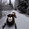
mgooding Posted February 5, 2015 Author Share Posted February 5, 2015 Here is the trip. Pretty excited. Link to comment Share on other sites More sharing options...
whiskywizard Posted February 5, 2015 Share Posted February 5, 2015 Here is the trip. Pretty excited. That looks like a fantastic trip. I'd love to hear a follow-up report when you're home on how it went. Be careful on Simcoe. It's a big crossing (just under 40km if you navigate perfectly) and very tempting to pin the throttle and go. Be aware that there's quite a bit of sled, car, truck, snow cat and foot traffic out there, heading every which way, and to and from ice fishing "villages". The pressure ridges can range from small to huge, and there are even plowed ice roads with VERY large snow banks. Many of the hazards aren't easy to see, especially if the light is flat that day. Link to comment Share on other sites More sharing options...
mgooding Posted February 5, 2015 Author Share Posted February 5, 2015 Thanks for the advice I appreciate it. I have been across simcoe 4 times before. If it gets late we know some people in Barrie we can stay at. Link to comment Share on other sites More sharing options...
ravinerat Posted February 5, 2015 Share Posted February 5, 2015 There also well worn paths to follow on Simcoe. If your crossing at the top of Cooks Bay where the trail is it's short. Been out running it this week. The pressure cracks are crossable just find where others have been going. RR Link to comment Share on other sites More sharing options...
TheNavigator Posted February 6, 2015 Share Posted February 6, 2015 WOW!!! Now that's a cool trip...! Link to comment Share on other sites More sharing options...
mgooding Posted February 6, 2015 Author Share Posted February 6, 2015 There also well worn paths to follow on Simcoe. If your crossing at the top of Cooks Bay where the trail is it's short. Been out running it this week. The pressure cracks are crossable just find where others have been going. RR Awesome thanks. WOW!!! Now that's a cool trip...! Yeah I am hoping the trip goes through and nothing comes up Link to comment Share on other sites More sharing options...
ravinerat Posted February 8, 2015 Share Posted February 8, 2015 Your map shows you coming down on the Oro side and crossing to Beaverton. Just head toward Georgina Island then a bit north to Beaverton. Don't forget to have a compass with you. If the weather blows up at least you can travel in a straight line. Even if you have a GPS take a compass. If I am off when you come I'd be glad to cross with you guys. RR Link to comment Share on other sites More sharing options...
mgooding Posted February 8, 2015 Author Share Posted February 8, 2015 Your map shows you coming down on the Oro side and crossing to Beaverton. Just head toward Georgina Island then a bit north to Beaverton. Don't forget to have a compass with you. If the weather blows up at least you can travel in a straight line. Even if you have a GPS take a compass. If I am off when you come I'd be glad to cross with you guys. RR Sorry I am confused by what you mean? And I would gladly ride with you, that would be awesome; Link to comment Share on other sites More sharing options...


Recommended Posts
Archived
This topic is now archived and is closed to further replies.