


Gadgetman
-
Posts
639 -
Joined
-
Last visited
-
Days Won
3
Content Type
Profiles
Forums
Gallery
Posts posted by Gadgetman
-
-
54 minutes ago, snowgirl said:
Has anyone stayed at the Super 8 in Timmins this year? Wondering if the trail to access the hotel has been cleared since last year?
I cancelled ON and took the group to Val D'Or last week instead of the "big loop" through Timmins.
If no first-hand report from anyone, suggest you try the Timmins club president, as I believe I had some exchange from him (which I can't find (sorry)) regarding that trail and the hotel manager thinking the club would "fix" it.
Cheers
az
-
22 hours ago, 1049 said:
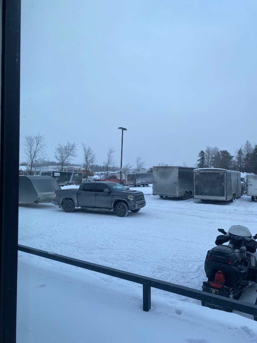
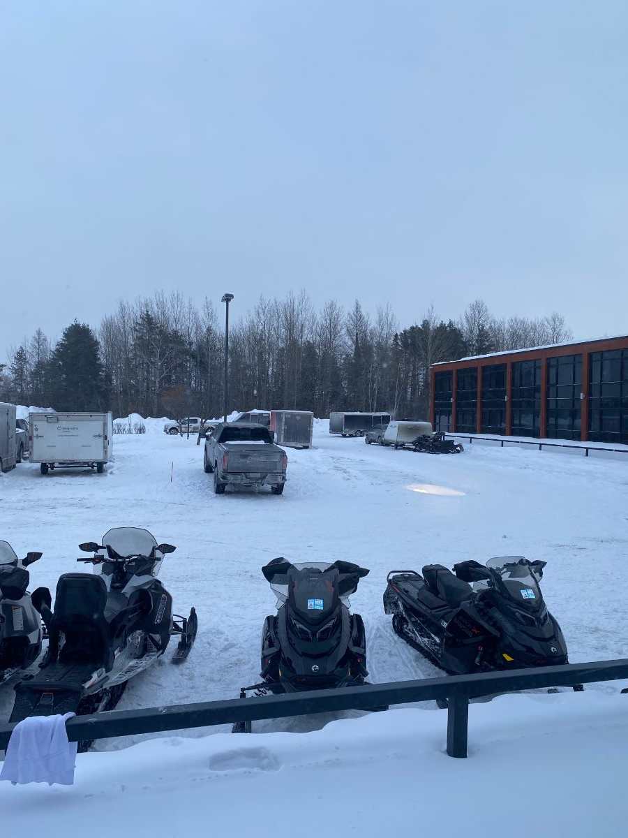
Trailers are pilling in at the Forestel


You must be in room 111 or 113, based on your view. This trailer, and I think the one to left of it was there when I was last week 11-14 Feb.
-
12 hours ago, PISTON LAKE CRUISER said:
Are you talking about Lac Faillon? Thats where I was talking about.
Sorry, my bad, apologize. I was talking about the hotel.
-
 1
1
-
-
40 minutes ago, PISTON LAKE CRUISER said:
Evening meal is premade, covered with saran and put in cooler. Pick the one you want and they will heat it up for you. Covid and not being able to keep a cook full time has meant its a no go for many former happy customers.
Ok. But that shouldn't then take 1 hr to be put on the table. Sunday was about 2/3rds full, Monday evening was less than half full in the restaurant. Tuesday. we ordered in a Pizza.
-
All,
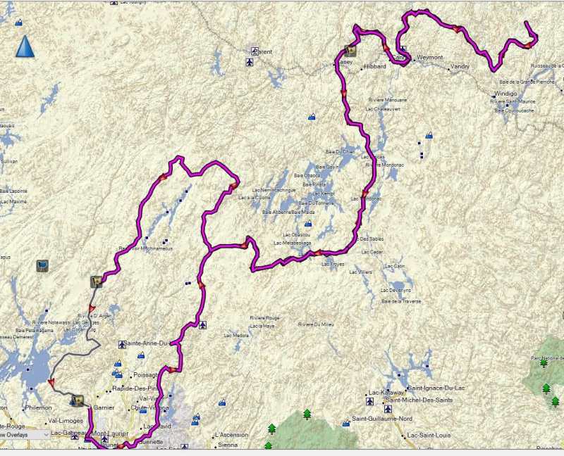
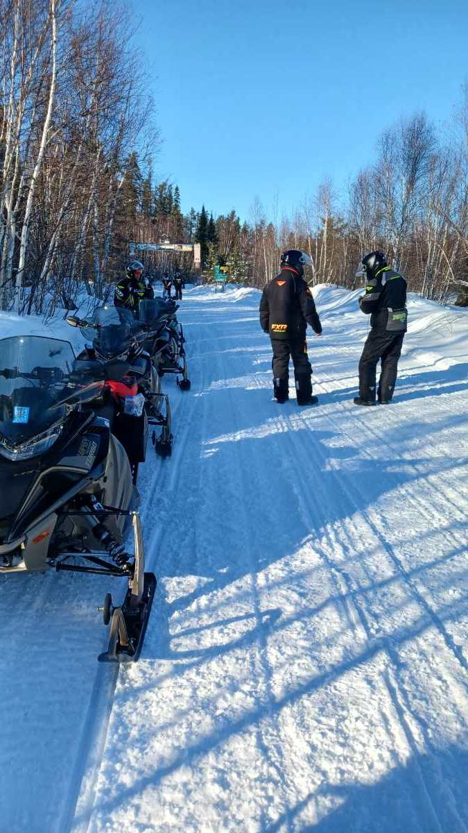
My group of 6 meet at the Forrestal at Val D'Or Sunday, and we did 3 day trips, total of just over 800KM's, so that the 3 new Sidewinders could get their breakin and first check complete. Trails QC Yellow for the most part, but were ON Green in many sections.
Day 1 was 386 Southbound . 1 big washout (may be fixed as trail Green today. South of the community, it becomes a travelled winter road, so we aborted and headed back. That trail was a hard Yellow this past Monday. (Day we did 25KM of the day 2 ride to check it out - Sweet ride!)
Day 2 83 - local connector - 83. (300Km round trip) We headed out to Lac Fillion for fuel and lunch (NO MENU - they have what they have when you get there, soup or sandwhich. $2\Litre (I dont know if Prem or not). Long open winding roads, except for the Yellow section which has forestry work, trail beside the road, snow covered but have to watch the trail. Small 1 lane washout.
Day 3 - (250KM) We headed West up to AMOS mostly on the 83, then the 307 North,. NOTE: The river in AMOS is open, so you have to cross a long-_ss bridge with traffic to head back East to the Amosphere for lunch. Took 93 and to 313 south. (Route outbound over the top of ValDOr, "Not nice" , maybe the route under VD West bound is nicer. Very nice ride except for Bridge and getting out of VD.
PDF of stats attached.
Pretty great save for this season. Looks like they got some of this snow, as many trails are Green today 16 Feb.
Hotel: Breakfast buffet - $25+tax. Club or Smoked meat sandwhich - $25. Waited 1 hour for meal both Sunday and Monday night. If you check Expedia, get the rate, call the hotel should\may match rate. Sunday to Tue was $187\night\room + TAXES. Wed $214\night + taxes.
Cheers
Andy

-
 12
12
-
1
-
-
On 1/29/2024 at 2:44 PM, tricky said:
Today, we pulled the plug on the Northern Corridor trip. Too far to drive to SRF or Kap for a couple of days sledding, especially for 2 guys who have ridden those trails more than we can remember. If the original group of 4 were going, we likely would have made the effort. Hoping winter comes back with a vengeance in the near future.
North just closed for a bit. I pulled the plug yesterday and our group is heading to Val-D'Or Sunday and doing 3 days of hub from the Forrestal.
-
1
-
-
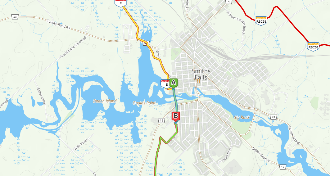
3 hours ago, Corners Guy said:
Hey Gadgetman,
It's a bit of a mix through Smiths Falls.
Here are a couple maps.
Map 1. Blue is groomed trail. Red are spots where you need to road run a bit.
The first section runs along the street and grocery store parking lot. side slope cannot be groomed but there is always a single track in the ditch to use. This leads you to crossing at Drummonds Gas at Lombard St. Next red is to get across the Rideau at Detached lock. Unfortunately it had to be extended up a couple of blocks as there is no agreement to use the old train bridge. Once you hang the sharp left you are in a paring lot that will lead you to the trail again.
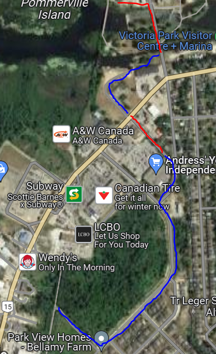
Map 2. Red is the parking lot mentioned in Map 1. Trail then picks up again and is off the road until you cross at highway 15.
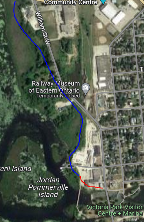
Obviously it's not ideal but the pavement is limited to probably a couple hundred meters in total. still some snowbanks to ride up on for some of it.
I haven't been down that way since RRRSC changed things to yellow and green. This is all past knowledge.
Very exciting to see what Rideau Ridge Riders SC has done over the last couple of years.
https://www.facebook.com/groups/160403710721723
Thank you. I see you identify a route a bit different than the current OFSC map, as on the OFSC it shows the trail continuing straight along the road after the locks and you show it (southbound) cutting to the right after the locks.
At this point, I'm going to drive around a bit and see where the trail is, before parking. Google street view doesnt show any no parking signs on Bellamy Dr (adjacent to forest in Pic 1 bottom)at the south west part of all of this, so I will likely park there.
thanks again.
-
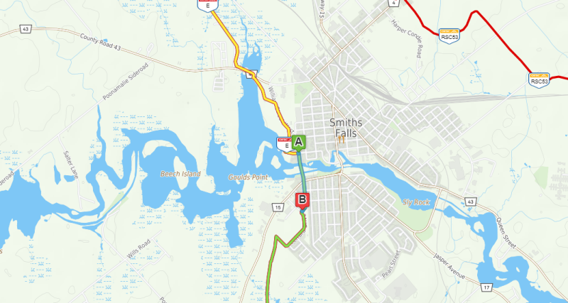
Looking at popping over to Smith Falls, and doing a loop from Smith Falls down to Harrowsmith, North E114E and either back on the E to SF, or just back track for the first run of the season.
Question is, this stretch thru town looks like it either sidewalk or road.
Can anyone provide some guidance or confirmation that the stretch over the locks is road, and short or road and ends up being long?
Thank you.
-
$100 plus any postage cost if needed.
-
Yes. I think it is\was about $40. What wasn't clear to me if there is an admin charge to process the insurance. There web site should have the details.
-
15 +years ago, give or take, that gap was smaller, but still needed you to arrange for a trailer shuttle. A trip across Canada, has been done once that I'm aware of, again, likely about 10 to 15+ years ago by group of guys who rode from out west back to Quebec (I think it was that way). They had support from many clubs along the way, and maybe even Ski-Doo at the time.
Losing the trail out of White River north thru Caramat and up to Longlac is a good example of how tough it is to support\maintain trails in sparsely populated areas.
That part of the province is pretty "sparse".
(Our daughter just drove that way last Spring on her military posting to Alberta, even in the car (Toyota Corrolla) , she had to plan her fuel stops carefully.)
-
2
-
-
On 10/25/2023 at 10:03 AM, PISTON LAKE CRUISER said:
There is no fuel station at Searchmount. The only way to get fuel there is to arrange with the gentleman at Driftwood Lodge to have some full jerry cans there for you when you arrive if he will. Its been a while since I've heard of him doing this. The fellow there to talk to is Carl.
Goulais River is the closest gas ther and its about 30 km. west of Searchmout I believe.
Thank you. I'll plan a trip out and back on 1 tank of fuel in this case.
-
Question: Doing 2 nights at Moose Horn Lodge in Feb, with a day trip down to Searchmount and back to Moose Horn; next day to Wawa and Duberville. Anyone know the distance (miles or KM (I can convert)), from Moose Horn (or Chapleau worst case) to Searchmount and is there fuel at Searchmount? (All 4S, and we will be carrying fuel.)
Thanks
-
On 5/15/2023 at 12:48 PM, 04nightfire said:
I'd keep an eye on Energy Powersports, FB marketplace and Factory Recreation
Where I've found the best prices on BRP fuel tanks.
-
2
-
-
Reached out to Dennis at the Hornepayne club on the build progress of the new Studio 6 Hotel. He reported that ground isn't yet broken, therefore at this point winter 2025 is the earliest it may be ready.
-
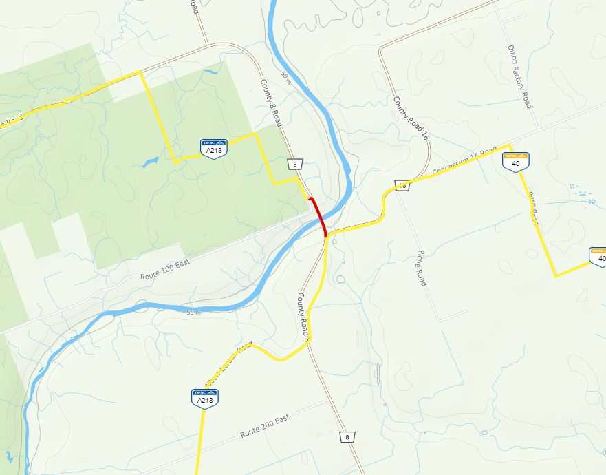
Some interesting "out of the box" ideas for sure. I agree that the sport needs new ideas to continue to be viable.
My thoughts are simplistic in comparison, I would like to see some functionality on the OFSC Trail map:
1. FCMQ has has a layer which shows when last groomed, why can't the OFSC map do the same; (Heck, New Brunswick shows the groomer in real time.)
2. I would like a third color (purple?) which identifies road running, and or bridges when the trail is open but be advised lack of snow. I see some clubs flip to Yellow for lack of snow, but no snow for a few KM's is a whole other matter for sleds. Example, the section in red is a long bridge, which is a road way, I expect that the club has identified that there is no snow on the bridge, not that the province told the OFSC that snowmobiles can't use the bridge. Flip that section to Purple - no snow road way.
As we all know, no snow on roadways or shoulders is very different than in the dead of winter when the ground is at least frozen. Also, I'm not talking about simple road crossing, I'm flagging when we have to drive along a road for hundreds of meters, and it is dirt, or rocks, or bare pavement.
My 2 cents.
-
5
-
3
-
-
9 hours ago, signfan said:
That sucks. I've got a 1.25" ice ripper with 22,000 km on it. Still in pretty decent condition. Not perfect but pretty good. It's in an xs chassis. I also have a 1.5" ice ripper on our other xs chassis sled. It's still fairly new. Just installed it last year. I'll have to watch the ice build up. We have definitely experienced ice build up in the tunnel on our saddlebag trips. Am considering carrying a rubber mallet to break it loose every morning. Especially if guys are saying it causes track lugs to tear.
Same situation. with about 5200KM on the 1.5 Ice ripper. Tried the very small rubber hammer and found its effectiveness limited. I may try to spray the sides (NOT on the Heat exchanger - has been the warning) of the tunnel with the Dupont Snow and Ice spray, which some people say it helps.
-
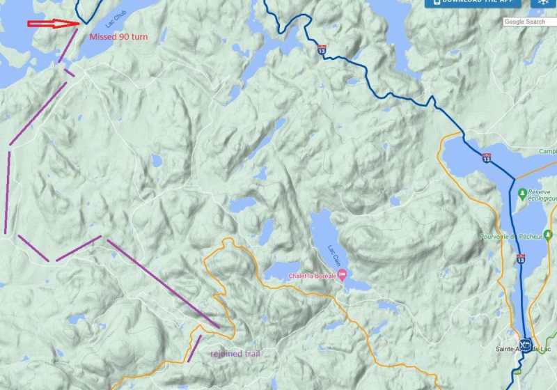
55 minutes ago, Fuse6 said:
Good report Gadgetman. Was that road from Nottawasi south groomed? I believe Fontbrune lodge grooms that trail themselves with their own groomer so they can do loops to the north more practical with their tour groups. Don’t know why it hasn’t become part of the FCMQ system.
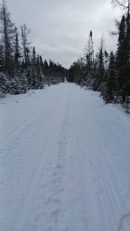
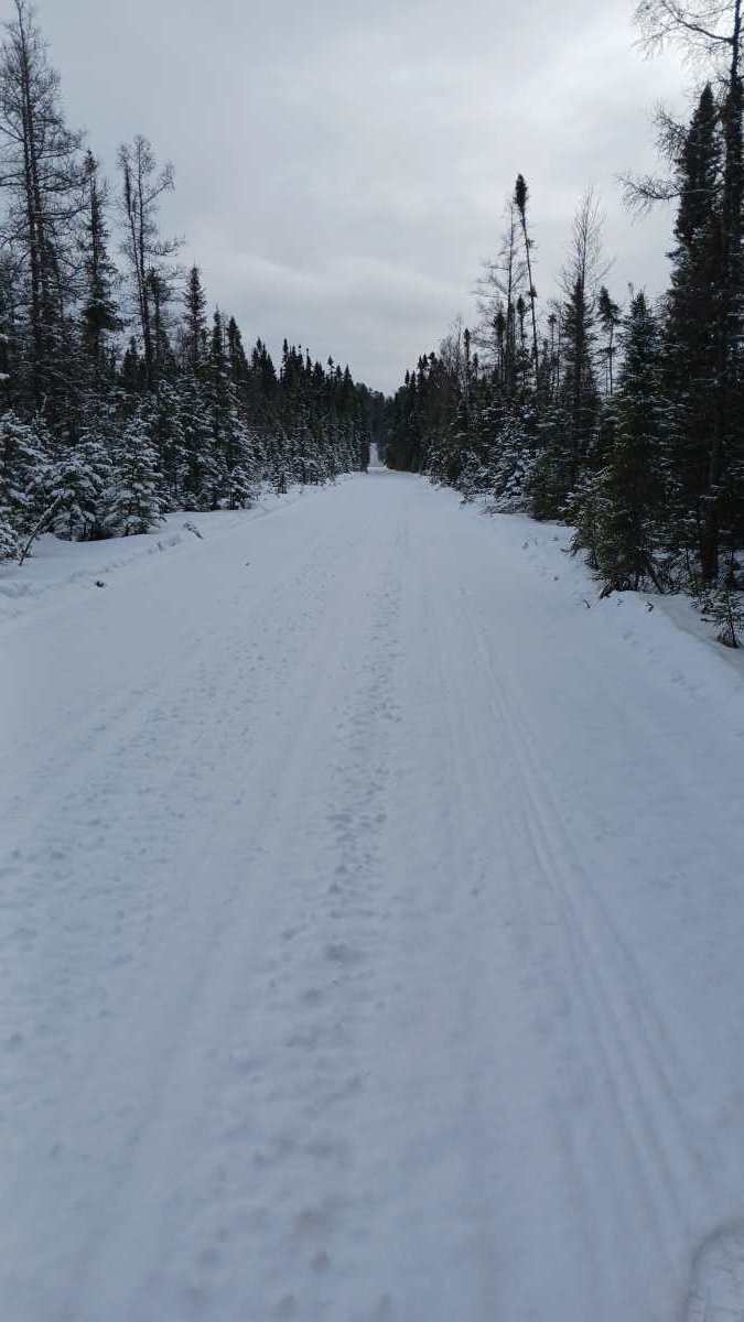
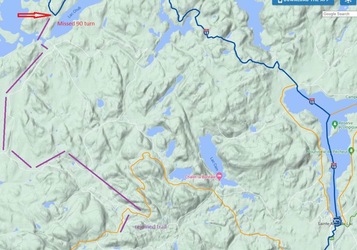
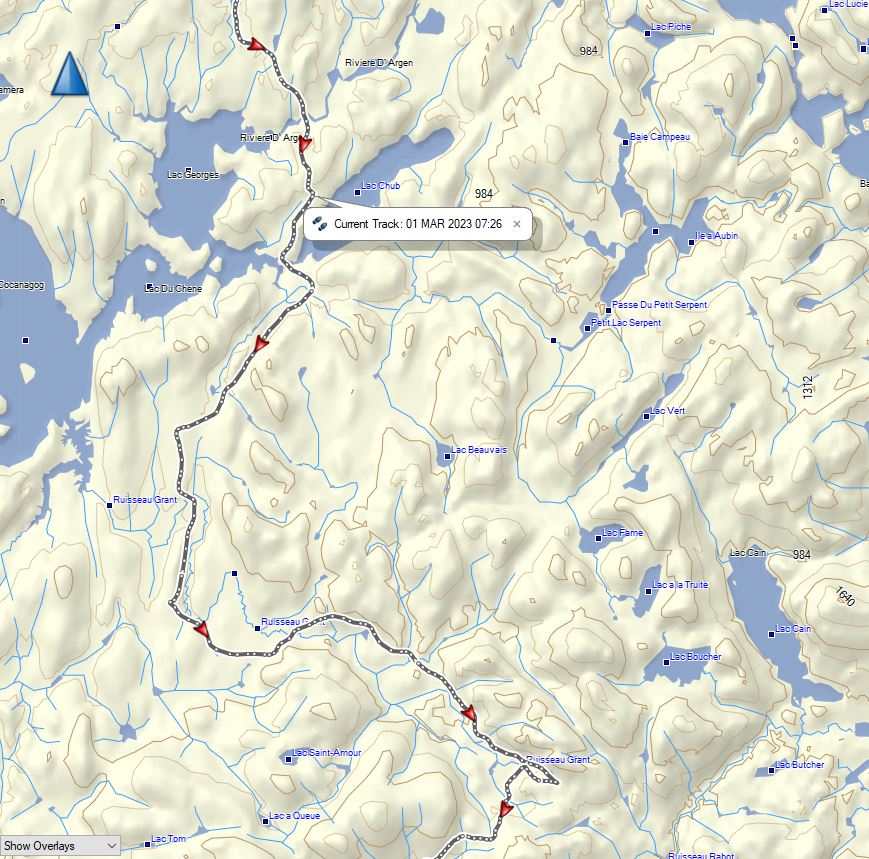
Trail 13 wasn't groomed yet, missed turn was about 22Km south of the Inn. Also, snow got deeper as we headed south to ML. I think why I missed the split, both the trail and road had a bout 1.5ft of new snow. Road had an ATV tire track on it, otherwise pretty deep and not used in the winter as best I could figure. Overall, this year I found the trail signage not as frequent as I have in past years.
-
1
-
-
2 hours ago, signfan said:
Does Notawissi have hot tubs?
Sorry, I don't know.
-
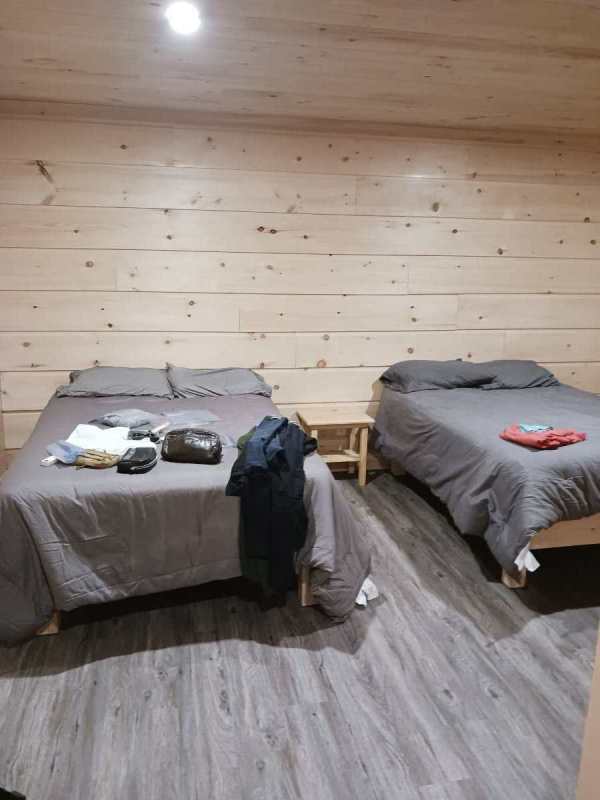
4 hours ago, blackjack1 said:
Those are the new cabins at Nttawissi in the picture Gadgetman?
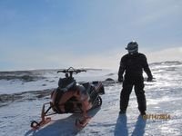
Yes. Replacing all the old ones with this style, my guess is varying sizes. I think at least 4 or 5 new cabins already.
-
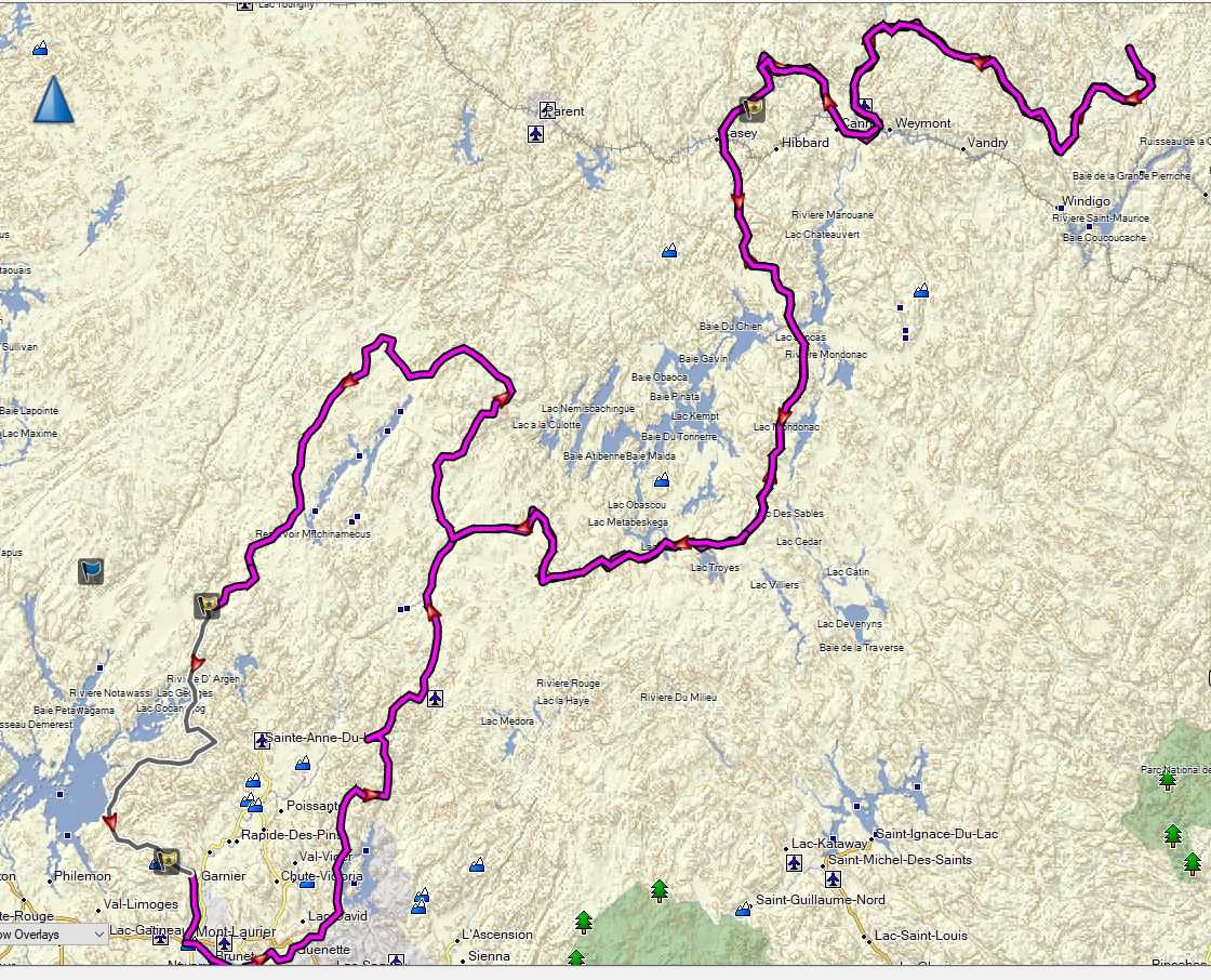
Saturday – Mont Laurier (Super 😎 to Mekoos to Pourviore Lac Du Repos (250Km day)
Route: Local E, 63E, 53N, L by lake, 53N, 319W – Mekoos (99KM)
Mekoos – Lunch starts at noon. Fuel was 2.423\Lt. 3 hot chocolates was $10.
Route: 53N, 33E – Repos (152KM). Fuel was $2.899\Lt (Cash\debit) (I used 22lt from Mekoos)
Cabin 7 – “very Rustic” – hunting\fishing cabin. Cabin was cold on arrival. Can of Stella 476ml was $10.50 each.
Dinner was good. Breakfast was scrambled eggs, bacon, ham, patats.
Sunday – Repos to Wemotaci (155Km) to Relais 22 (125KM) (280KM day)
Route: 345N, 83E
Wemotaci – snack bar – around the corner from fuel station starts at noon. Basic fare. (Skipped on return trip.) Grocery store across from fuel and next to 83 outbound.
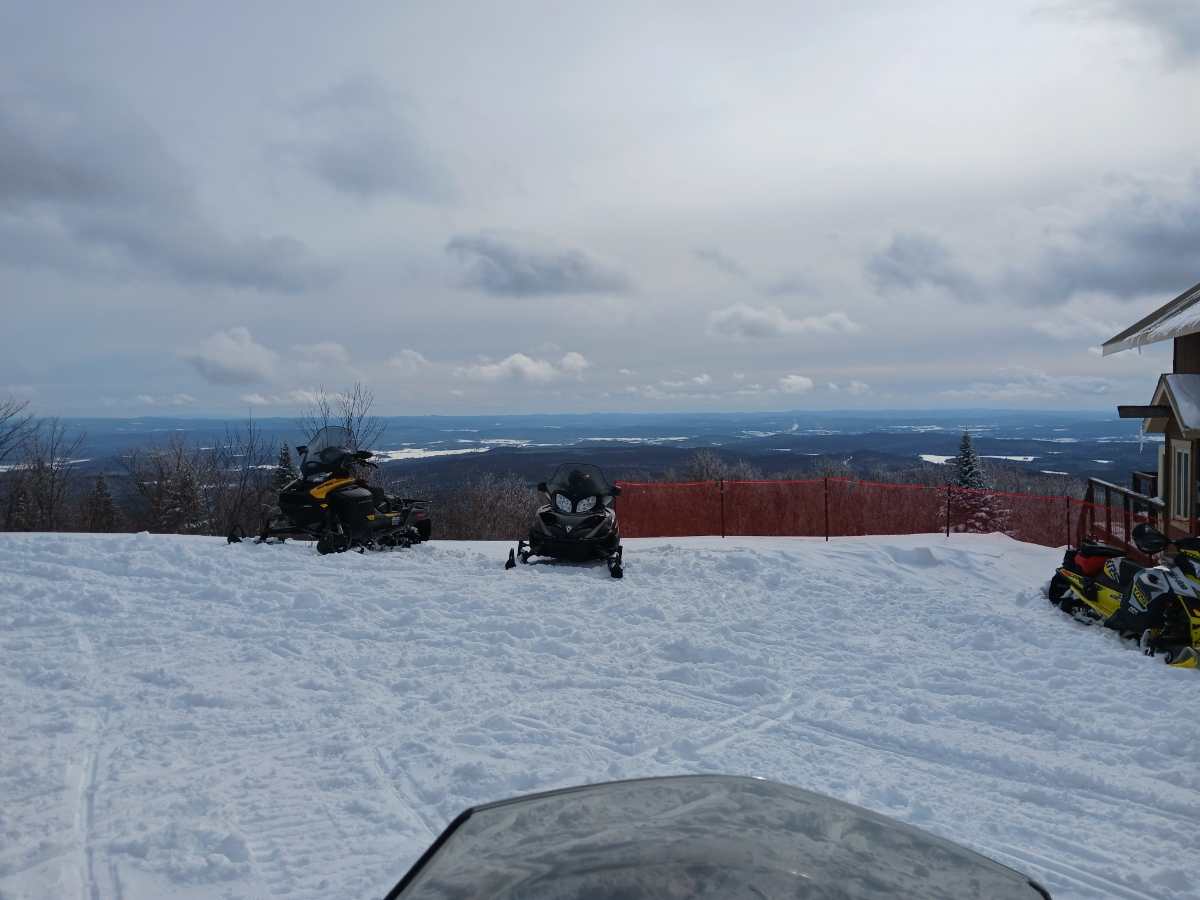
Gas was $1.70\Lt. Reg only. Steep climb out of town, with look out.
Relais 22 – fuel was $2.23\Lt Reg. Sleeping building has a common area and wings with rooms of different sizes. Our room was 2 single beds next to each wall and 3 ft between the beds, with a sink, all else down the hall.
Main building you have a reserved table, place was busy.
Monday – Back to Repos, same route
Wemotaci – fuel, ate what we brought at the lookout, picked up beer in store to bring to Repos.
Repos – Cabin 6 – not as “rustic”, cold cabin, had to fetch firewood. Dinner was good.
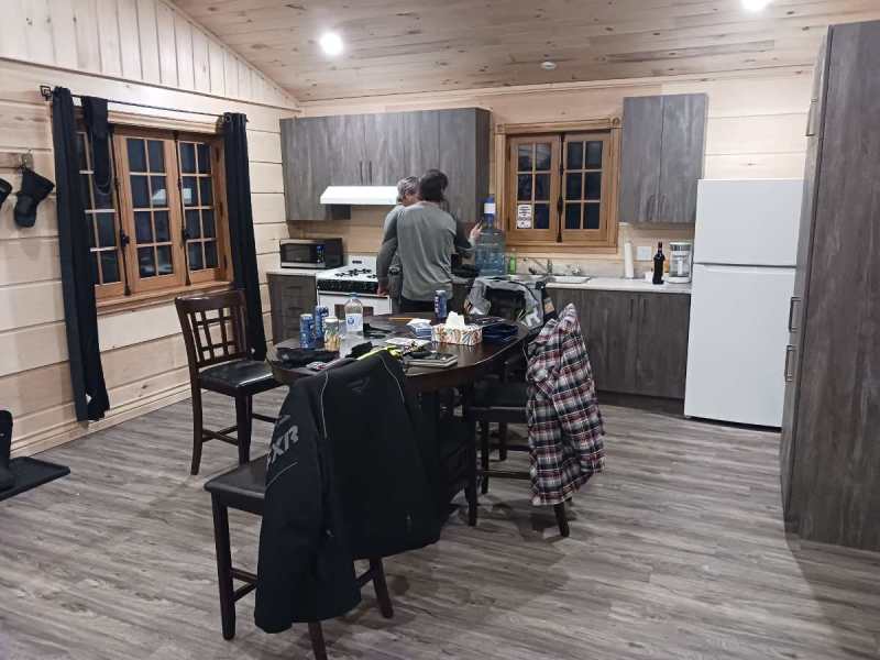
Tuesday – Repos to Club Notawissi (265KM day)
Tough day – significant snow all day, very hard to see the trail in the forest cleared areas.
Route: 33W, 33N, 13S. Fuel at Depanneur, Relais Lu-Nic , (103KM) Fuel $2.25\Lt Super Cash (maybe no debit either).
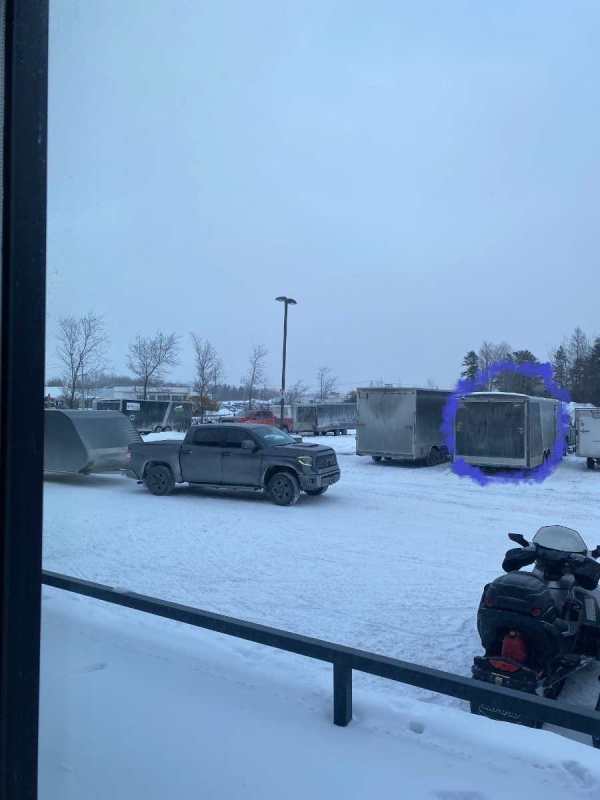
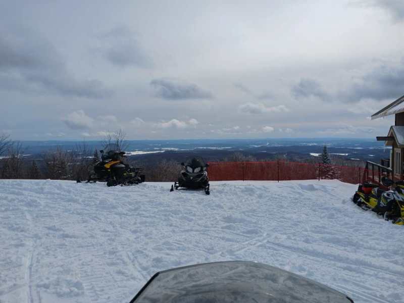
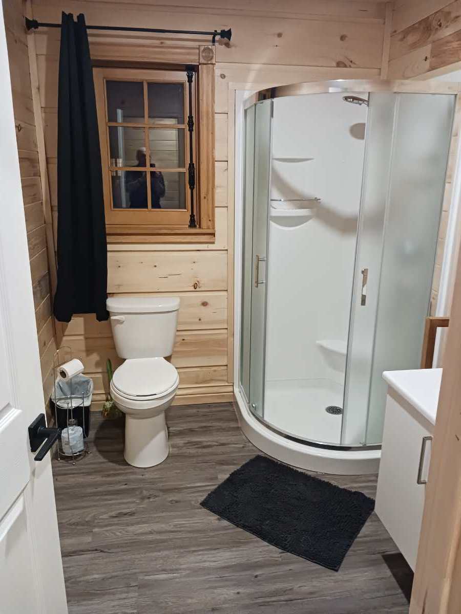
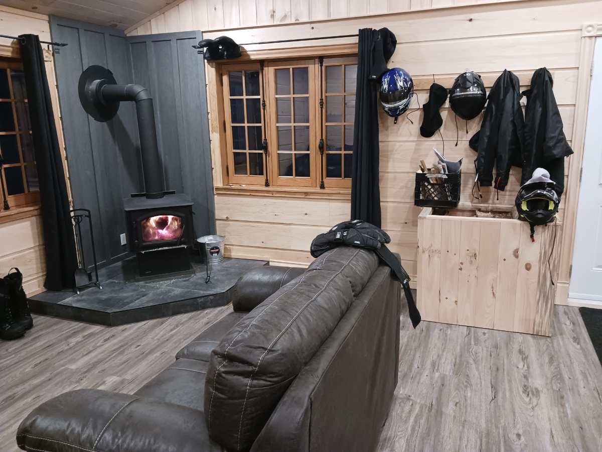
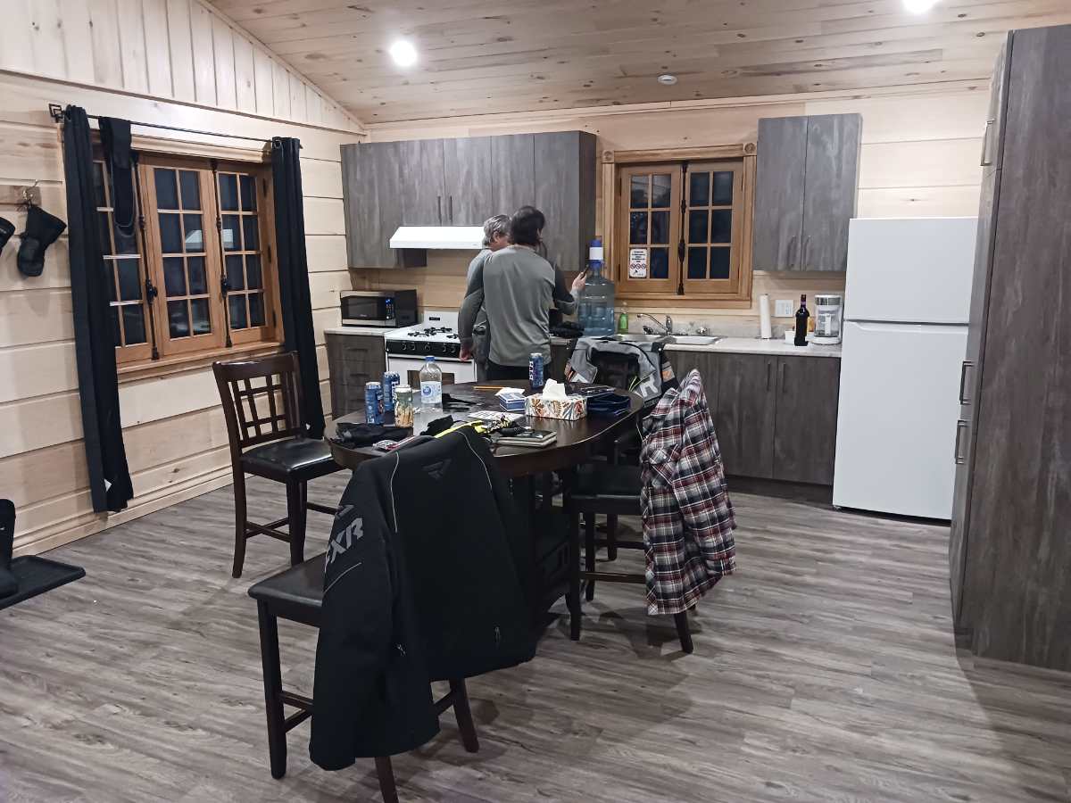
Club Notawssi – brand new chalets, ours had 2 bedrooms with 2 doubles and each BDR had its own bathroom with shower. Chalet was warm and roomy. Staging out of here with your wife is recommended. Pictures attached.
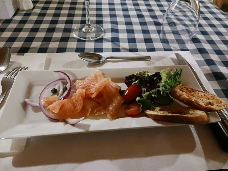
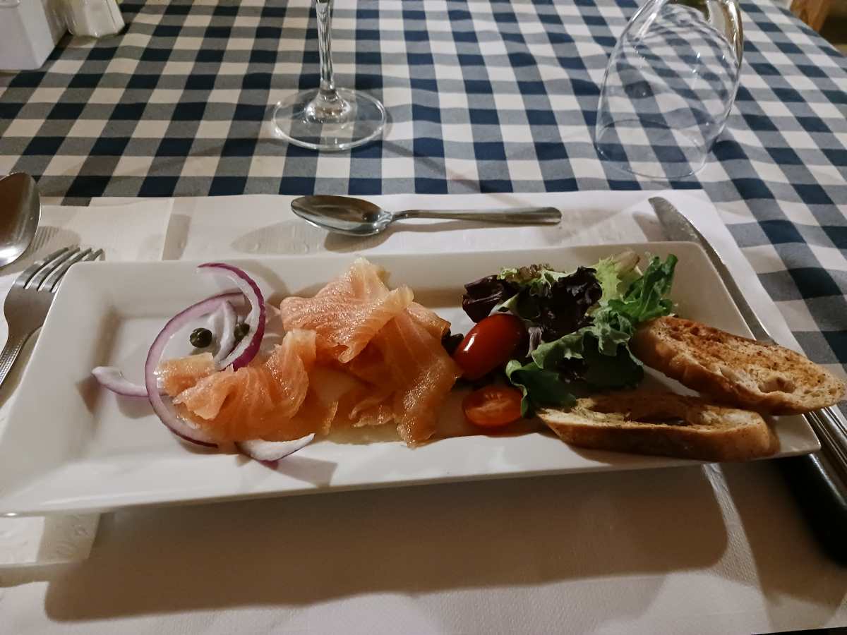
Dinner at main building – Smoked salmon appetizer, great main meal. Breakfast – made to order.
Wednesday – Club Notawissi to Relais Diable to Mont Laurier (113KM)
Route: Should have been -13S, 322N, 322S. Ended up on a closed road which caused us to by-pass Saint-Anne du-Lac. Luckly, the closed road joined the local trail north of the 13 before the 322. Did enjoy running about a foot and half of new powder on that closed road for many KM’s.
Did the look out at Diable – pretty impressive.
Opted to enter ML from west side, much shorter than crossing the town from the 63.
Stayed Friday night Super 8. Best Super 8 breakfast ever. They have a large parking lot across the main road and just over a bit for truck and trailer parking, while away sledding


-
11
-
-
Trail to HP wasn't open yet when we were up at Hearst a few weeks ago. However, year before we asked the Companion to make us sandwiches which we ate on the trail for lunch. One year, we bought hot dogs at the Esso station and ate them in the parking lot. With the new hotel planned, hopefully it drives a full-time restaurant.
-
31 minutes ago, PISTON LAKE CRUISER said:
I can see the trail (L27) that you leave to go up the hill into the parking lot being the clubs responsibility but the goat path up the hill is not properly staked or signed so there is no way in my opinion that it is a trail the local club is responsible for. If we are talking about the same goat path it goes up into the Casey's restaurant parking lot from trail L27. I don't believe the club would want a groomer to go up there. BTW trail L27 is shown green on the ITG today.
Yes, it is that goat path up to the Casey's restaurant parking lot, and yes, best I can remember it has gone from a groomed snow filled trail many years ago to overgrown bush. The Super 8 still contributes to the trail map, why I was so surprised of how many fallen small trees are across the trail.
Well, he responded and said he would take a look, which is reasonable. If he opts to do nothing, then I guess it becomes the Comfort Inn down the trail in the future, because crossing the highway is a safer option than that trail, according to our group.
-
Our group have been using the Super 8 in Timmins for over 20 years. I have pictures of me sitting in the lobby in my PJ's after my first blown piston. Years ago, they had a groomed trail up the back side, which is steep. We've watched it go from a groomed trail to what it is this year, having trees down across a goat path, which required us to climb over several trees and then hill climb.
Therefore, I gave the Super 8 a harsh review. Credit to him, the GM responded and identified that the trail was the Timmins club responsibility, which is what I thought. I accepted that but replied that every club is struggling for volunteers, and the fact that he is a business with a maintenance guy, and just 30-60 mins with an electric chain saw could make the trail at least safe for all levels (and ages) of riders.
His reply was that he and his maintenance guy would walk out and take a look.
If someone opts to stay at the Super 8 in Timmins, can you let me know if the rear sled trail was cleared of the fallen trees?
Thanks
-
1
-
 1
1
-


Mont Valin QC - Feb 24 25 26 trip
in Main Clubhouse
Posted
Thanks for sharing. Only a 7.5 hr drive for me and only doing a QC sled permit next year, so I will add it to my destination list.
Mont Apica was an old Early Warning radar base, back in the day.
From Wikipedia, the free encyclopedia:
Canadian Forces Station Mont Apica (CFS Mont Apica) was a radar station of the Pinetree Line, located in Mont-Apica, Quebec, Canada, during the Cold War. The station opened as RCAF Station Mont Apica in 1952 and had a staff of some 500 persons at its peak.
2452 AC&W squadron, a reserve unit from Quebec City, trained at Mont Apica until the squadron was disbanded in 1960.
Political and technological changes made the station redundant and it closed in 1990.[1] No. 12 Radar Squadron, Mont Apica's lodger unit, was transferred to CFB Bagotville.
There was also a weather radar used by the military and later by the Meteorological Service of Canada. After the station's closure, it was transferred to the Lac Castor site of the Canadian weather radar network.