


AC+YA
-
Posts
1,279 -
Joined
-
Last visited
-
Days Won
9
Content Type
Profiles
Forums
Gallery
Posts posted by AC+YA
-
-
On 12/21/2019 at 7:59 PM, PISTON LAKE CRUISER said:
I just noticed on the ITG that there is a loop on the D trail about 19 km. south of C101D Both sides of the loop are marked as D. The west side is about 15 km. and the east side appears to be about 23 km. I've never noticed this loop before. Is it new? Is it a one-way portion on the D trail??
The new "west" trail was cut and opened last season by the Soo Trailblazers. The old "east" part was the old trail. Perhaps they are keeping it on the map for future need if logging takes the new shorter side. The new west side bypasses a wet area north of Toll Creek Road where it seems to washout during warmups and beavers have caused issues in the past. The old east route is partly the big haul road which connected Chapleau to Searchmont and had been logged over several seasons causing issues in past years. That was the fast open area along the Hydro Lines where the road ran. I believe the east side will be used when possible.
I heard the logging is taking Whitman Dam road and a bypass will be groomed around that this year as it has in the past. I heard something about another washout also, but have not ridden from Searchmont yet.
-
The Queens has a pool and maybe a hot tub. The Companion closed the hot tub down years back. You can still keep your sled in the heated garage of the Companion, but it costs an extra $5 / night and if it is full you are out of luck. We still walk next door 15 meters to the restaurant and lounge at the Companion if we stay at the Queens. We use both.
-
 1
1
-
-
On 12/18/2019 at 6:58 PM, Techdenis007 said:
If you think that little red patch would stop me ....
Last season I got my ski caught in a crack and it traveled until it wedged under frozen sod. My daughter and I were not letting a little red patch stop us either. I got lots of negative feedback over that and was asked to never go on red trail sections again. I am trying to be good! It was not on private land BTW.
I was just wondering if something had changed to cause another re-route in that section since it did show yellow and went back red? In any event, many will soon be wanting to journey along that trail including myself. Great to see all the work being put into the system so early this season!
Thanks to all those making the trails possible. Happy Holidays.
-
16 hours ago, PISTON LAKE CRUISER said:
I think what Denis wrote about was the trail from the monument going west. The area that is red now is south and east of the monument. If I remember, that area of the trail goes through a lot of bush and swampy areas.
Correct. There is a loop around a water hole/pond and very wet area and some other swampy areas as you go to the east. It was yellow and went back to red. That's what I was wondering about. Hearst is no longer connected to Kap.
-
10 hours ago, cookster said:
ITG a nice welcome to see it this am, A is open Cochrane to hearst and lots of extra's to boot. heading out Monday now that there is room to roam.
The map seems to have changed and there is a stretch of the A trail red again from Opasatika River west to the Monument on Hwy 11 ?
-
I got my 3 permits in about 10 days. They came through 2 services to get to Michigan. My son's came quicker in about 7 days. When the clubs sent them years back I remember getting them in as little as 4 days.
I am sure that the Quebec permits will come within a week, but have until December 9th to get the discount.
-
13 hours ago, Ox said:
I buy 2 passes every year. (except 2010 through 2012 as we were having issues making payments and groceries)
There are seasons that we just don't make it out to ride at all if we are real busy in the shop, even tho I have $400 of permits paid for already.
When we doo ride, we try our best to stay away from groomed trails.
We very easily could git away without a tag since we really don't use the trail system, but The Queen flew my sorry assets out of the bush for free years ago, so I make sure that she is reimbursed.
If those tags get very $alty tho - I may change my mind.
.
Since 2001 I've purchased between 2 and 8 permits every season. It is quick and easy now, but miss calling the clubs direct and talking about the upcoming season. They always mailed the permits free of charge and I got them within a week every time. Now with all the news on the internet I know most of what is going on before I head to Ontario. Ordered 3 permits this week.
-
1
-
-
19 hours ago, ToSlow said:
Anyone have any info on these sleds they can share? I'm looking at a new 2017, new old stock
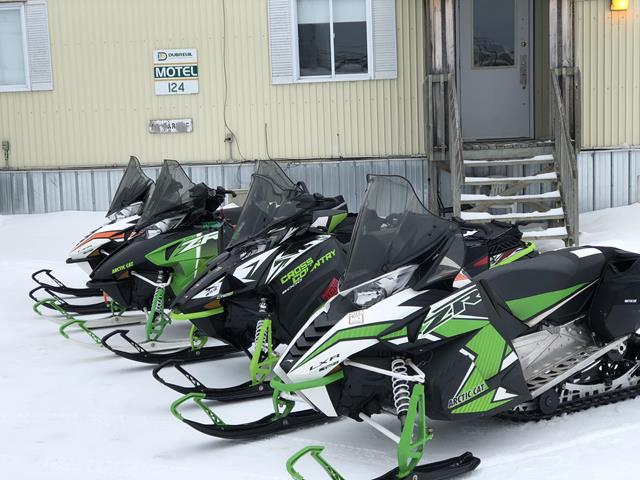
Between me and my friend, we have a total of 7 years on 2016 models with 137" tracks. They both went 130 to 137 miles before running out of fuel on a full-burped tank. I think the sled will be fine for 2 seasons with just basic maintenance. I would check chain tension after a few thousand miles and suck out chain case oil and replace each year. After 1 or 2 seasons you need to pull the brake rotor and caliper apart to grease that drive shaft bearing. Never had to worry about the rear axle tri-hub if you tighten it up each year and grease the bearings while you have it apart. The tri-hubs do come loose if only because it is plastic which only tightens so much before it deforms so not so tight either. Only had issues starting at -38°C while parked outside overnight in Timmins once. Stuck a hair dryer inside clutch side panel and closed it while running for about 10 minutes and good to go. Had to tighten front shock spring under track to lighten front end feel on mine, but my buddy had one which was fine with same setting. Think spring was different on mine. Good acceleration and steering, but that suspension will not transfer weight to raise skis off snow by design.
If you like to follow close, buy the radiator screen to stop the fins from being folded over. Easy to install. Good trail sleds and never overheat! Some extra steam when running deep new powder snow. Ran 12,000 miles with just normal maintenance. Reliable.
-
2
-
-
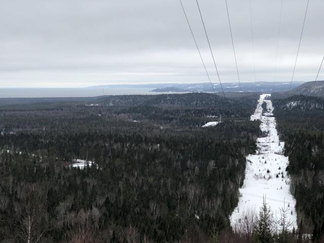
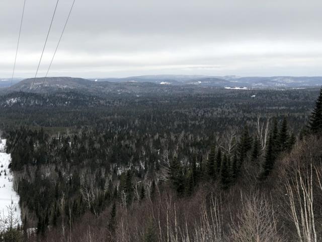
On 3/15/2018 at 5:29 PM, Ox said:
Where was that split in the Hydro taken?
Isn't that Marathon?
You didn't mention Marathon in your schpeal.
.
Hi Ox,
Just ran across this, sorry.
That is the lookout in Wawa. I passed it for years before I noticed it and wasn't in a hurry.
-
7 hours ago, Dmarks said:
Wondering if there is any updates on conditions? Heading up next week. Thanks
Should be OK with some new snow they got last weekend. Watch the ITG and there is way more snow north now then back when we took these pictures. Dan Senior is up there and is the guy to PM.
I will be back up in a couple weeks.
-
On 1/20/2018 at 9:19 AM, AC+YA said:
Rode Searchmont to Dubreuilville yesterday with lunch at Halfway. Never went to Wawa.
Trails fast hard and watch for rocks the groomers pulled up. I liked it except needing to watch for rocks. Trail as good as it gets but could use more snow. Groomers fixed all water crossings. Great job up to Halfway.
After Halfway going north much more snow!
All good. Wawa 5 was fantastic so we cut through to the Magpie which is marked better than I have ever seen it.
Markers are seen from the one you are passing.
No more guessing and much safer at night or in snow storm. Great job to all.
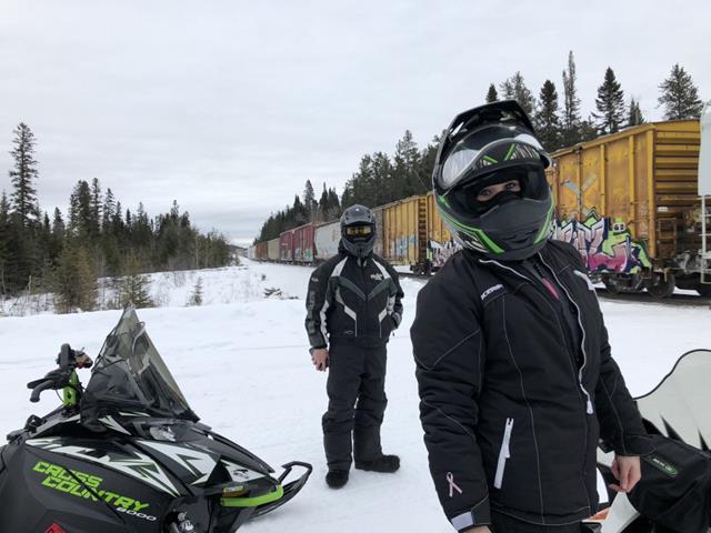
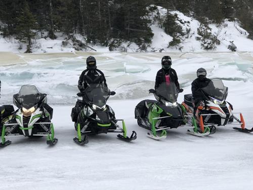
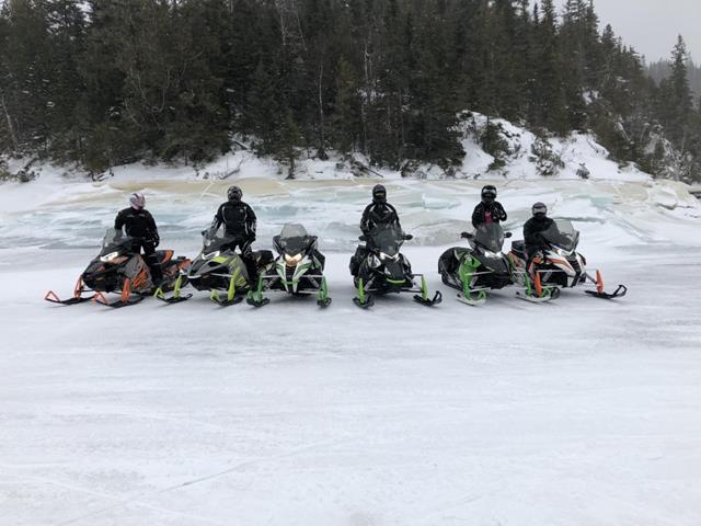
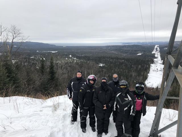
Came back down from Dub to Wawa on the Magpie. Got gas in Wawa, hit the lookout and on to Halfway for gas and a birthday party for my boy Graham. Headed over to spend the night at Valentines in Chapleau. Trails were good in Wawa and better than I had thought they might be. Getting a bit bumpy on the hydro before Halfway. Then real nice all the way to Chapleau. The only reason I figure the trail is yellow from Hwy 129 into Chapleau is the hazards which need to be driven around, but are not an issue as long as you see them. If they were marked, that trail would be about as good as I have ever seen it. Go slow until you know where the issues are and there are a few. Stopped and marked the water crossing on the way back to Searchmont. Hit that from the blind side on the way to Chapleau so thought we would try to save the innocent from the panic attack I had gone through as I skidded into the water the night before. It is about a couple miles east of Pineal Lake (the bridge where the old saw mill was). Not deep, but at least it is marked now. Lets face it, all water fixed with snow only goes back to water. Found one wet spot on the way down to Searchmont which had also been fixed, but warm weather has erased almost the entire fix. Think that is about 7 miles before the trail Tees into Ranger North West Road near Dyson Lake. I think the Halfway groomer goes to the "T". The trail was still good hard and fast down to Searchmont. Watching for a few rocks in the trail was key. We stopped and removed several from the trail, but some were too big and frozen into the snow to even budge. The trails all seem to be better this year when it comes to branches hanging out. The crews have done lots of good work. The trail over to Goulias River from Searchmont had taken a beating by the warm and grooming up those big hills, but we jumped onto the river and ran it to "The Zone".
Now with the snow they received yesterday as we were leaving, they should have something to work with again. The trails should be great again once they can groom them and have some snow to work with. Real good weekend ride.
Got ride with 1049 (Mark & Pam) also ran into Skidoo boy (Eric & Lynne) on the Magpie.

-
7
-
-
Rode Searchmont to Dubreuilville yesterday with lunch at Halfway. Never went to Wawa.
Trails fast hard and watch for rocks the groomers pulled up. I liked it except needing to watch for rocks. Trail as good as it gets but could use more snow. Groomers fixed all water crossings. Great job up to Halfway.
After Halfway going north much more snow!
All good. Wawa 5 was fantastic so we cut through to the Magpie which is marked better than I have ever seen it.
Markers are seen from the one you are passing.
No more guessing and much safer at night or in snow storm. Great job to all.
-
1
-
-
I thank everyone for all the good info put out on this, especially the originator of the post who was trying to inform everyone of the trail closure.
I understand that the interactive map cannot be used to plan a trip as noted in this case, but does a good job of informing all viewers of trail status put forth by the clubs.
-
The Polar Bears (the club) need to notify the interactive map people at the OFSC that the trip planner is still allowing trips to be planned on the A105Q this season.
The free weekend in Quebec is coming on Feb. 6th & 7th and many have used this trail to enter and or leave in past years. Last year it was deep snow and opened just prior to the free weekend. Many may assume that this year will be the same and the map shows it to be a viable trail. That may be the only weekend that this trail gets lots of use?
Riders coming to the Ontario border on Sunday expecting to run through to Cochrane will be faced with great hardships and may try to break trail thus running out of fuel and worse.
Everywhere you look for direction on trails points you to the interactive and it is not giving anyone the correct info about trip planning.
-
Wow!
Had a big trip planned using this trail to enter and exit Quebec from Cochrane.
We start in the Soo and run up through Halfway, Chapleau, Foleyet, Timmins, Cochrane, and then use the A105Q trail to get into Le Reine
and all places beyond. Great people and places way north in Ontario and Quebec. Love exploring uncommon routes way north.
Then coming back west around the top and back down to Dub. The northern corridor is fantastic.
This takes Cochrane out of the Quebec trip as I will most likely run direct to Smooth Rock Falls before starting west.
I just checked the trail map and there is no disclaimer about this trail being shut down this season! Just figured it was still closed
due to an all around slow start this season.
Why use the maps to plan when they do not protect you by passing along changing trail info?
I am glad I finally heard it on here and can cancel lots of reservations for our group trip.
I was in Cochrane 4 times last season, but now it looks like we won't be going at all this year.
A BIG Thanks to Lillabelle Lodge for informing everyone!
This would have been a great big mess otherwise, but I am still greatly disappointed!


Borrowing a sled - Moral dilemma
in Main Clubhouse
Posted
I have asked interested family members to come experience riding in Northern Canada because it is so nice. My brother is coming this season from Arizona to ride. I asked him to come.
I have had one of my son-in laws come along. Two seasons back we made a great loop from Searchmont through all of the Northern Corridor and back down the other side to Searchmont. Last season from SSM east and back including days of Drummond Island and using the tree line back and forth to St. Joseph Island. The north shore was the best I have ever seen it with lots of snow.
He crashed and rolled a different sled during each trip, but I was still happy that he loves riding. He offered to pay, but in wanting him to come I had already figured that since I invited him, he would not be held responsible for any issues. He had never ridden a sled before since he is from southern Illinois. The key is that I asked him to use my sleds.
I have loaned a sled in the past, but a friend asked to take it due to his being in the shop. At that time I agreed with the understanding that he fixes or buys the sled for $X,XXX in the event of issues. After all, he asked me to use the sled, I did not invite him to use it.
My question is, did the friend ask to use it, or was he invited to take it on the trip?