Yukon
-
Posts
1,556 -
Joined
-
Days Won
14
2 Followers

-
See you this weekend Kevin! Coming up Saturday night.
-
Should be any day now with him testing and tuning his zero turn!
- 5 replies
-
- 10
-

-
Jeff also club V.P and groomer coordinator! Great guy..
-
You can pick and choose your days for riding on a multi day ontario trail permit, but they must be back to back days.
-
This storm is going to be the starter for lots of clubs! Stamped it!
-
Can you include in your report on how your carbides, sliders and temps of your sled fair as well? 😆 🤣
-
If I was a betting man, I would keep my eye on Kawartha lakes Snowmobile club District 8, between Fennlon falls and Kinmount for a Christmas cobweb shaker limited riding.
-
That was the year Severn sound from Port Severn over to Midland skimmed over around November 26th .
-
$7.50 pays the 3 party furnishing house to manage the permit distribution. $10 tracking fee is optional OFSC Excom positions are all voluntary, even the Secretary/Treasurer.
-
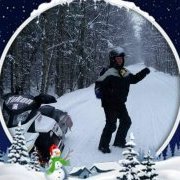
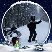
R.I.P #177 May you test and tune in paradise.
-
The interactive trail guide is the only source for trail status updates. It requires real time updates and must be mirrored by any digital sources, that is in agreement with the OFSC. A trail guide is for quick view of the region you want to ride in, with not much detail. I can sympathize with those using trakmaps, I am one of them. Just bought a new garmin Zumo.. I am also the one who gets the call when an incident occurs, at anytime of the day.
-
I remember a time when when the world of snowmobiling didn't want to embrace the digital era. That were all up in arms, when we left the text based trail status updates. Trail -2023 - open- from uncle stuckys outhouse, to the big tree at shits creek.. This wasn't a knee jerk reaction, and we have some very good people leading this volunteer driven organization. Insurance, risk management and liabilty are all very real. Always check the interactive trail guide for what trails are available for access!
-
We need to find a way to track this. It will give a truer picture of our trail fund allocations. We can always use more money...