Carm Posted January 26, 2016 Share Posted January 26, 2016 We are planning a ride this Wednesday and I have heard that 3 bears camp is no longer open for gas and food, can someone please confirm? Where else in Shining tree can we grab a bite and fuel up? Link to comment Share on other sites More sharing options...
northstar Posted January 26, 2016 Share Posted January 26, 2016 there is gas but no food Shining Tree Camp 705-263-2034 Link to comment Share on other sites More sharing options...
DARKSIDE Posted January 26, 2016 Share Posted January 26, 2016 If you read some of the posts about Shining Tree, I have a Petro Canada gas station and grocery store. We have never been out of gas in the last 25 years here and don't plan to anytime. Had about 40 guys in here last weekend. And yes you're right, Three Bears is closed completely. There are no restaurants in Shining Tree anymore. I have lots of food here but no fast food other than chips, chocolate bars, sweets and cold drinks. And we sell Premium gas only. Link to comment Share on other sites More sharing options...
AkronOrange Posted January 26, 2016 Share Posted January 26, 2016 I'm hoping to up your way this weekend. Does anyone know the status of the L143 (Grassy) or C trail north to Timmins. They're still red on the OFSC map. Any info would be greatly appreciated. Link to comment Share on other sites More sharing options...
Carm Posted January 26, 2016 Author Share Posted January 26, 2016 If you read some of the posts about Shining Tree, I have a Petro Canada gas station and grocery store. We have never been out of gas in the last 25 years here and don't plan to anytime. Had about 40 guys in here last weekend. And yes you're right, Three Bears is closed completely. There are no restaurants in Shining Tree anymore. I have lots of food here but no fast food other than chips, chocolate bars, sweets and cold drinks. And we sell Premium gas only. Perfect! Are the trails freshly groomed from your place to Sudbury? See you tomorrow. Link to comment Share on other sites More sharing options...
DARKSIDE Posted January 26, 2016 Share Posted January 26, 2016 That's fine. We'll be here. And this is for you AkronOrange, no, Grassy is not groomed and not a sanctioned trail. And I'm not telling you to use it. But there are about 75 to 100 a weekend that are. There is a groomed trail somewhere headed for Timmins. I've called the guy that runs the groomer 15 to 20 times to get information from him, for the guys calling here and the guys coming up. He has not returned even one phone call and I don't expect he will. So there you go! Link to comment Share on other sites More sharing options...
AkronOrange Posted January 26, 2016 Share Posted January 26, 2016 Carm - I received message from Sudbury that they will be grooming the C trail to Shining Tree this week Thanks Leon, I know Grassy hasn't been open for a few years, but it's on the map again. News about it is on their Facebook page and can be read here: http://ontarioconditions.com/forums/index.php?/topic/15654-next-weekend-trip/ Hope to see you on Friday. Link to comment Share on other sites More sharing options...
Carm Posted January 26, 2016 Author Share Posted January 26, 2016 Carm - I received message from Sudbury that they will be grooming the C trail to Shining Tree this week Thanks Leon, I know Grassy hasn't been open for a few years, but it's on the map again. News about it is on their Facebook page and can be read here: http://ontarioconditions.com/forums/index.php?/topic/15654-next-weekend-trip/ Hope to see you on Friday. Hopefully they are grooming today/tonight and C trail is perfect for us tomorrow. Link to comment Share on other sites More sharing options...
AkronOrange Posted January 26, 2016 Share Posted January 26, 2016 Have a good ride. Please post info about your ride if you can. We'll be up there in a few days. Link to comment Share on other sites More sharing options...
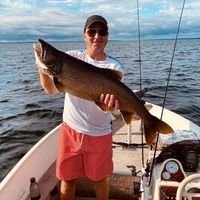
Carm Posted January 28, 2016 Author Share Posted January 28, 2016 What a great day of riding we had. Left the house at 4:30am, hit the trails by 9:30am in Sudbury, rode 50km and gased up at Rocky's took the freshly groomed C trail to shinning tree gased up and back, gased in Capreol, and then back to the truck by 5:30pm. All and all 400km day and we saw a wolf, linx, and deer on the trail. Perfect blue bird day and met a great guy at Shining tree that gave us great info about the area, we are going back again next Wednesday! Link to comment Share on other sites More sharing options...
RogerApex Posted January 28, 2016 Share Posted January 28, 2016 Carm beat me to a post as it took a while to upload all the photo's - After waking up at 4am Wednesday morning and making the 3.5 hour drive to Sudbury from Orangeville we hit the trail around 930am or so from the south east end of Sudbury. We looked for the closest drop point that we could ride and connect from. Our motto is that we would rather ride our sleds then sit in the truck any longer to hit a drop point. We made our way to the C trail via Caproel. As there is limited fuel we decided to do our last refuel at Rocky's on the shores of Wanapitei Lake then shoot all the way up to Shining Tree as we found out that the groomers just did the whole section over night and again that same morning via the spot tracker website. We wanted to include the lookout near sportsman's lodge but we were told at Rocky's that the lake just froze over recently and only showing around 4 inches around the shoreline!!! So that's when we decided that the lookout via the lake access was going to be out of the question. All refueled we blasted up the C trail to Shining Tree. We followed only two sled tracks in front of us all the way on well groomed trails. If anyone was wondering from Rocky's to Shining tree it's a short 140km via my Garmin GPS. Arriving at Shining Tree we met the Groomer who had been out all night and hadn't slept yet but refilled our sleds. That's dedication and we thanked him a few times grabbed some fuel and chocolate bars and blasted back to Sudbury for a total days ride of 400km for an Wicked Wednesday. So for all of you guys that don't have snow at your doorstep which i'm going to gather is everyone looking at the OFSC trail map this morning; load up the rig and go to the snow. It's too short not to get out there. If you don't believe me that there is riding to be done look at the pictures attached. Link to comment Share on other sites More sharing options...
Blake G Posted January 28, 2016 Share Posted January 28, 2016 Carm beat me to a post as it took a while to upload all the photo's - After waking up at 4am Wednesday morning and making the 3.5 hour drive to Sudbury from Orangeville we hit the trail around 930am or so from the south east end of Sudbury. We looked for the closest drop point that we could ride and connect from. Our motto is that we would rather ride our sleds then sit in the truck any longer to hit a drop point. We made our way to the C trail via Caproel. As there is limited fuel we decided to do our last refuel at Rocky's on the shores of Wanapitei Lake then shoot all the way up to Shining Tree as we found out that the groomers just did the whole section over night and again that same morning via the spot tracker website. We wanted to include the lookout near sportsman's lodge but we were told at Rocky's that the lake just froze over recently and only showing around 4 inches around the shoreline!!! So that's when we decided that the lookout via the lake access was going to be out of the question. All refueled we blasted up the C trail to Shining Tree. We followed only two sled tracks in front of us all the way on well groomed trails. If anyone was wondering from Rocky's to Shining tree it's a short 140km via my Garmin GPS. Arriving at Shining Tree we met the Groomer who had been out all night and hadn't slept yet but refilled our sleds. That's dedication and we thanked him a few times grabbed some fuel and chocolate bars and blasted back to Sudbury for a total days ride of 400km for an Wicked Wednesday. So for all of you guys that don't have snow at your doorstep which i'm going to gather is everyone looking at the OFSC trail map this morning; load up the rig and go to the snow. It's too short not to get out there. If you don't believe me that there is riding to be done look at the pictures attached. Gotta love it when a plan comes together. Nice job, nice photos. Link to comment Share on other sites More sharing options...
AkronOrange Posted January 31, 2016 Share Posted January 31, 2016 Great posts guys. We are just finishing a similar trip. We're sitting at Sportsman now as I write. We started in Sudbury on Friday, rode around Wanapitae then back to Sudbury Friday, 125 miles. We rode the 78 trail, it was rustic! Saturday we went from Sudbury to Shining Tree then to Aulde Reekie in Gowganda, 175 miles. Dianne, Urs and their children are awesome hosts; great company and spectacular food and accomadations. After a great breakfast we hopped on our machines and headed to Sportsman for another great meal. The clubs have done a great job with the trails given the warm temperatures and marginal snow. I appreciate all of the hard work if all of the volunteers. Sincere thanks to all involved! Link to comment Share on other sites More sharing options...
SlowTouringGuy Posted February 1, 2016 Share Posted February 1, 2016 Great posts guys. We are just finishing a similar trip. We're sitting at Sportsman now as I write. We started in Sudbury on Friday, rode around Wanapitae then back to Sudbury Friday, 125 miles. We rode the 78 trail, it was rustic! Saturday we went from Sudbury to Shining Tree then to Aulde Reekie in Gowganda, 175 miles. Dianne, Urs and their children are awesome hosts; great company and spectacular food and accomadations. After a great breakfast we hopped on our machines and headed to Sportsman for another great meal. The clubs have done a great job with the trails given the warm temperatures and marginal snow. I appreciate all of the hard work if all of the volunteers. Sincere thanks to all involved! Auld Reekie is agree spot. How are you enjoying Sportsmans? Both spots have gas. Hope we can connect again on the trails. Maybe update the last photo op. Is Ferndale Freddie still riding with you? Link to comment Share on other sites More sharing options...
coolbane Posted February 1, 2016 Share Posted February 1, 2016 Good posts. How far is it from Capreol to Gowganda? Just wondering if it is possible to make it all the way without detouring into Shining Tree for gas. Thanks Link to comment Share on other sites More sharing options...
Carm Posted February 1, 2016 Author Share Posted February 1, 2016 Good posts. How far is it from Capreol to Gowganda? Just wondering if it is possible to make it all the way without detouring into Shining Tree for gas. Thanks No more detour to shining tree; the OFSC map is incorrect, it is 100ft off of the C trail. Groomer operator has a little premium gas and convenience store set up there, he is a great guy! Link to comment Share on other sites More sharing options...
coolbane Posted February 2, 2016 Share Posted February 2, 2016 No more detour to shining tree; the OFSC map is incorrect, it is 100ft off of the C trail. Groomer operator has a little premium gas and convenience store set up there, he is a great guy! You are right, the interactive map and paper map look quite different in that area. Is either of them right? Where exactly on the C trail is he located with the gas? We are heading up the C from Suds, then cutting across A107C to Gowganda. Link to comment Share on other sites More sharing options...
coolbane Posted February 2, 2016 Share Posted February 2, 2016 252 kms according to the Ontario Mileage Database on Sledzilla. Thanks, but the trip planner on the Interactive Map lists is as 172 KM. Did I screw something up? If it is only172 km, then it is within tank range Link to comment Share on other sites More sharing options...
Blake G Posted February 2, 2016 Share Posted February 2, 2016 Thanks, but the trip planner on the Interactive Map lists is as 172 KM. Did I screw something up? If it is only172 km, then it is within tank range My apologies, coolbane. This was my first time using the database. I downloaded the app last night on my phone and was keen to try to use it when you posed your question. I was not wearing my glasses, and quoted the distance to Gowgama rather than Gowganda. The database shows 198 kms from Capreol to Gowganda. I see this differs from the 172 kms you quoted from the ITG. When I look more closely at the route used in the database, and then use the ITG to click on the same trail sections, I get 188.1 kms with the ITG. (The database route uses Lake Wanapetei, which I guess is a faster route, when available? Maybe trails were rerouted at some point?) Again, my apologies for using you as a guinea pig while I experimented with the database. The database does look like a useful tool, as it is quicker than clicking on all the trail sections with the ITG. revrnd from this site is the man for the database. Link to comment Share on other sites More sharing options...
AkronOrange Posted February 2, 2016 Share Posted February 2, 2016 We rode there yesterday. It's about 130 miles from Capreol to Gowganda. We went into Shining Tree for gas. It's 12 miles from the A107C junction to the gas pump in Shining Tree then 50 miles to Gowganda from Shining Tree un less you want to try to ride the side of the road then it's about 30 miles. Couple things to watch for on the A107C; there are 3 small washouts within the first 5 miles from C, then there is a logging operation preparing to haul. It's about 6km, and it wasn't scrapped to the stones, but it did appear that they were getting ready. It was definitely worth the trip. We also rode from Shining Tree to Sportsman, 102 miles if you take the 78 trail. PM me if you want any more info about the area. Link to comment Share on other sites More sharing options...
revrnd Posted February 2, 2016 Share Posted February 2, 2016 My apologies, coolbane. This was my first time using the database. I downloaded the app last night on my phone and was keen to try to use it when you posed your question. I was not wearing my glasses, and quoted the distance to Gowgama rather than Gowganda. The database shows 198 kms from Capreol to Gowganda. I see this differs from the 172 kms you quoted from the ITG. When I look more closely at the route used in the database, and then use the ITG to click on the same trail sections, I get 188.1 kms with the ITG. (The database route uses Lake Wanapetei, which I guess is a faster route, when available? Maybe trails were rerouted at some point?) Again, my apologies for using you as a guinea pig while I experimented with the database. The database does look like a useful tool, as it is quicker than clicking on all the trail sections with the ITG. revrnd from this site is the man for the database. Thanks for the props. Yes, there are issues w/ reroutes. The distances are only as accurate as the GPS info I got while up north (haven't done a Northern Blastoff since 2012. If any one keeps track of their trips up there, could you winnow it down (w/ the routing) & pass it along to me? I guess I could use the ITG, but I've been stuck to the computer updating the lodging database w/ Google Earth. Link to comment Share on other sites More sharing options...
Blake G Posted February 2, 2016 Share Posted February 2, 2016 How accurate are the distances shown by the ITG? Are they calculated with recent GPS data from the groomers? Link to comment Share on other sites More sharing options...
revrnd Posted February 2, 2016 Share Posted February 2, 2016 quicker than clicking on all the trail sections with the ITG. How accurate are the distances shown by the ITG? Are they calculated with recent GPS data from the groomers? I think they are. Maybe Ned Nickerson could prepare a mileage database like mine for the OFSC when he's not riding around on freebies. It would save me a lot of time. Link to comment Share on other sites More sharing options...
Canuck Posted February 2, 2016 Share Posted February 2, 2016 Interestion of C and A107C last April. Zoom in for mileages on the signs. We proceeded straight to Gowganda. You'll know your range at that point. Link to comment Share on other sites More sharing options...
kered Posted February 2, 2016 Share Posted February 2, 2016 Canuck, good post, you are 100% correct, this is the present mileage going East bound on the A107C @ the "C" trail. The North bound is 21 km into Shining Tree via the C trail which now goes through Shining Tree. A trail has just been completed that goes along the old 560 highway route which is just along side the new one. No more back tracking. The L142 is now only 1 km into Shining Tree Camp for premium fuel. The picture you posted will change slightly when the logging operation completes that Akron was referring to. It will then be 55 kms to Gowganda and 16 kms into Shining Tree from the C trail & A107C junction. Now for the C trail North there is indeed a bridge being refurbed that is between Tata chika pika & Post 392. They say two weeks @ best and a month @ worse. We will open the C trail from Shining Tree to Tata chika pika as soon as the Mattagami lake is staked & C trail North signed. [ working on it today ]. The new C trail I spoke of along the highway will take a few days to brush & sign now that we finished building the bridges this weekend and I can get the groomer over, [ I hope ]. Look for about a week on that. Now, the NEW L 143, not to be confused with the OLD L 143 will run the powerline from Timmins to the A107C about 100 kms long and will intersect where the powerline joins the A107C between Gowganda and Shining Tree. You will be about 20+ kms into Shining Tree or 30+ kms into Gowganda. This will be signed and opened after it is complete. Urs is packing it today and I'm on call while I sign the C North. The routes are NOT accurate on the interactive right now but hopefully they will get it changed. There is a lot of reroutes annually and I'm sure they are letting the dust settle. Look for both NEW L143 and C North to be open, @ least to Tata chika pika in the next week. Happy sledding, Derek. Link to comment Share on other sites More sharing options...


Recommended Posts
Archived
This topic is now archived and is closed to further replies.